Most of the world’s population currently lives in cities with that percent only expected to increase in coming decades. Access to nature is an important part for city residents as urban areas become increasingly development and dense. There is a myriad of green space types - from gardens to green roofs to parks - but the latter provides the greatest accessibility and opportunity to city residents. Urban parks provide a range of ecosystem services, including providing cooling in summer, a place for recreation or socialization, and biodiversity benefit. However, understanding how residents use parks remains challenging.
Monitoring how people use city parks is inherently difficult. Parks have many entrance points, there are generally no restrictions on access, such as time of day, and green spaces are numerous throughout the city landscape. Using anonymized location data from smart devices can be an effective way to estimate not only how many people visit parks, but at what times and where they go when they get there. I am working with Mapbox and using their movement data to better understand how people use city green spaces.
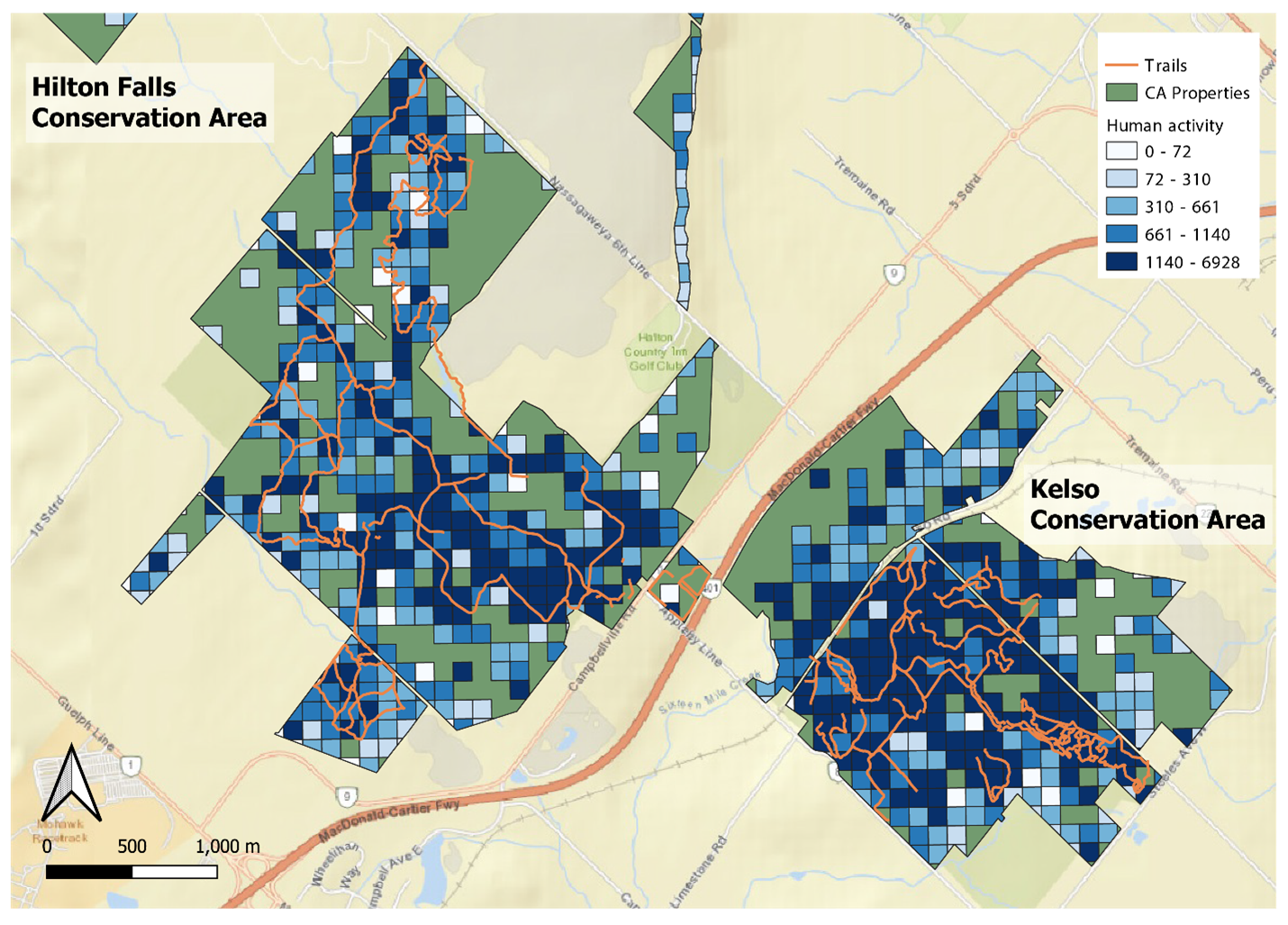
Currently, I am working on two projects that use this anonymized location data. Firstly, I am using the data to see how people use green spaces in Halton Region specifically where they go and their trail use, through a partnership with Conservation Halton. Second, I am working with the Toronto and Region Conservation Authority to see how green space use might vary during extreme heat waves as some residents head to parks to cool down. The latter project is particularly important with Toronto increasingly experiencing more summer heat waves as a result of climate change. I am open to connect with other municipalities or regional governments that may be interested in understanding how people use parks in their local areas.